


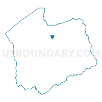
Voting District 2230, Salt Lake County, Utah
About
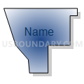
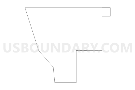
Outline

Summary
| Unique Area Identifier | 678992 |
| Name | Voting District 2230 |
| County | Salt Lake County |
| State | Utah |
| Area (square miles) | 1.20 |
| Land Area (square miles) | 1.20 |
| Water Area (square miles) | 0.00 |
| % of Land Area | 100.00 |
| % of Water Area | 0.00 |
| Latitude of the Internal Point | 40.75348420 |
| Longtitude of the Internal Point | -111.90004150 |
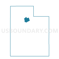
Maps

Graphs
Select a template below for downloading or customizing gragh for Voting District 2230, Salt Lake County, Utah


Neighbors
Neighoring Voting District (by Name) Neighboring Voting District on the Map
- Voting District 2206, Salt Lake County, UT
- Voting District 2220, Salt Lake County, UT
- Voting District 2223, Salt Lake County, UT
- Voting District 2226, Salt Lake County, UT
- Voting District 2228, Salt Lake County, UT
- Voting District 2255, Salt Lake County, UT
- Voting District 2256, Salt Lake County, UT
- Voting District 2260, Salt Lake County, UT
- Voting District 2264, Salt Lake County, UT
- Voting District 2306, Salt Lake County, UT
- Voting District 2362, Salt Lake County, UT
- Voting District 2370, Salt Lake County, UT
- Voting District 2371, Salt Lake County, UT
- Voting District 2422, Salt Lake County, UT
Top 10 Neighboring County Subdivision (by Population) Neighboring County Subdivision on the Map
Top 10 Neighboring Place (by Population) Neighboring Place on the Map
Top 10 Neighboring Unified School District (by Population) Neighboring Unified School District on the Map
Top 10 Neighboring State Legislative District Lower Chamber (by Population) Neighboring State Legislative District Lower Chamber on the Map
- State House District 26, UT (33,477)
- State House District 24, UT (32,363)
- State House District 23, UT (31,676)
- State House District 30, UT (29,672)
Top 10 Neighboring State Legislative District Upper Chamber (by Population) Neighboring State Legislative District Upper Chamber on the Map
Top 10 Neighboring 111th Congressional District (by Population) Neighboring 111th Congressional District on the Map
Top 10 Neighboring Census Tract (by Population) Neighboring Census Tract on the Map
- Census Tract 1028.01, Salt Lake County, UT (6,106)
- Census Tract 1028.02, Salt Lake County, UT (5,063)
- Census Tract 1029, Salt Lake County, UT (4,500)
- Census Tract 1026, Salt Lake County, UT (4,420)
- Census Tract 1025, Salt Lake County, UT (3,460)
- Census Tract 1030, Salt Lake County, UT (2,954)
- Census Tract 1023, Salt Lake County, UT (2,760)
- Census Tract 1140, Salt Lake County, UT (1,501)
- Census Tract 1021, Salt Lake County, UT (1,457)